
WHAT WE DO
Accurate, affordable and always available
SeaSignal delivers coastal intelligence when safety and performance demand it, using low-cost hardware, simple installation and automated, real-time products.
Products
Our algorithms turn raw wave data into actionable insights
Bathymetry and shoals
Nearshore depth and shoal positions across the coverage area, tracked over time
Surface and rip currents
Speed and direction of surface flow, including rip currents
Wave heights
Measured across the whole field of view
Wave periods
The time between successive wave crests
Wave directions
The direction from which waves approach the coast
The system
Compact hardware, automated processing
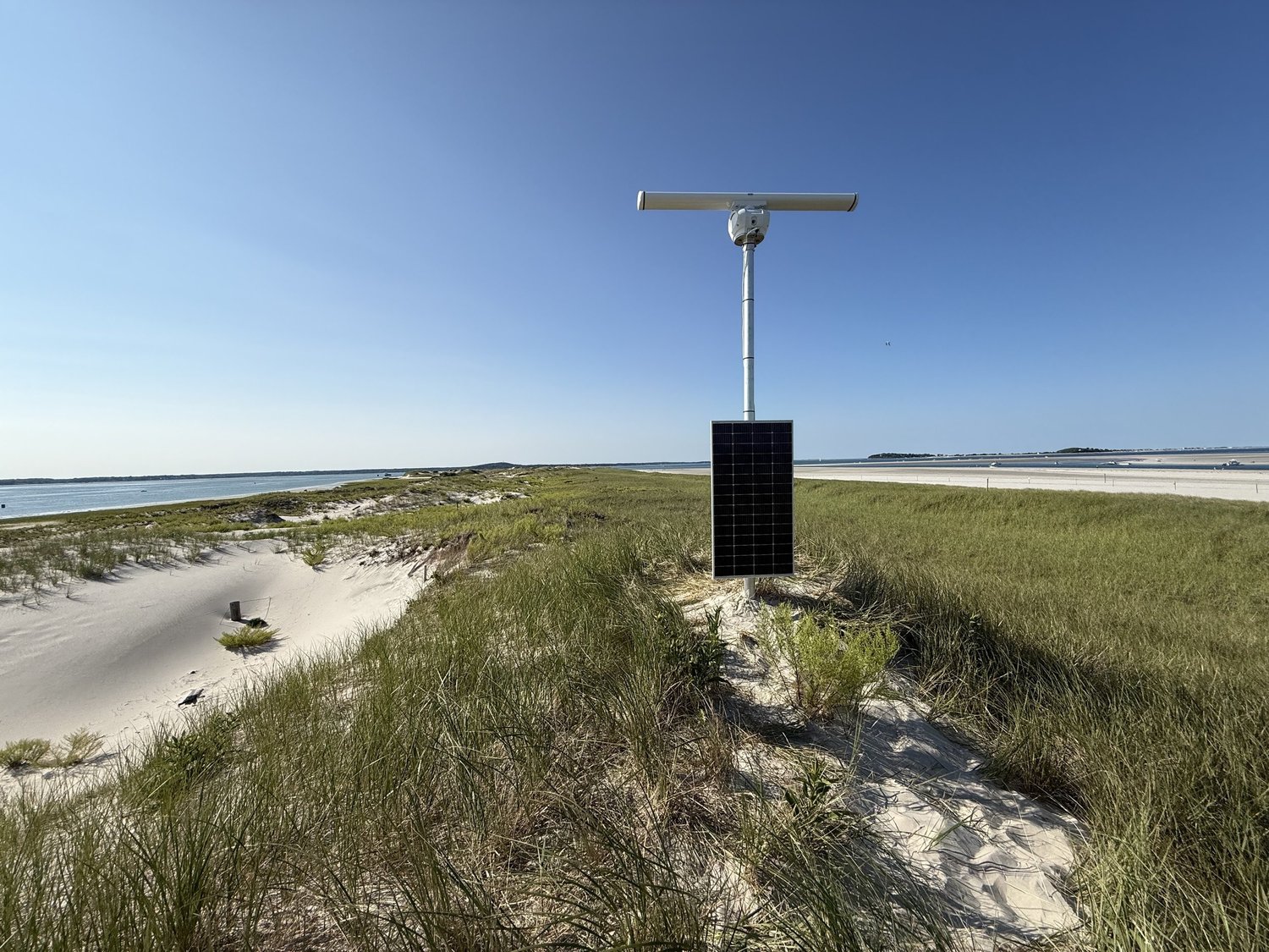
SeaSignal systems use compact, weatherproof, modular hardware, offering flexible deployment and coverage of up to 30 km², reaching up to 4 kilometers from shore.
All data is autonomously uploaded and processed through our proprietary cloud software, hosted by Coastal Measures, delivering customized insights to clients in under five minutes.
Low-cost hardware, simple installation and minimal maintenance, combined with automated real-time products and scalable data-leasing options, make SeaSignal a strong option for many coastal stakeholders.
Specifications
At a glance
Download the full spec sheet (PDF) →
| Coverage | Up to 30 km², out to 4 km from shore |
|---|---|
| Results | Within five minutes of each collection |
| Products | Bathymetry and shoals, surface and rip currents, wave height, period and direction |
| Hardware | Compact, weatherproof and modular X-band radar |
| Power and data | Solar power and cellular data, with Starlink as an option where cell service isn’t viable |
| Mounting | Tower or existing structure |
| Data hosting | CUMULUS cloud platform, run by Coastal Measures |
Pricing options
Ways to work with us
Tell us about your site
Send us the location and what you need to measure. We will tell you what a system can see from there and what installation would take.
Or email info@seasignaltech.com